A 360° tour of Gran Canaria made for Isleta Design Studio.
The island of Gran Canaria is often considered as a “micro continent” because it presents a great variety of landscapes and microclimates, managing to pass from the mountains to the sea, even to the desert, in a short time. Exploring the island during these two years we have been able to admire different types of coasts, from golden sand beaches to the volcanic ones, framed by evocative and always different landscapes. Thus, imagining a 360° tour of the island, starting from Las Palmas in a clockwise direction, we decided to inaugurate our new website and the first blog article with a series of original illustrations that show the main coasts of Gran Canaria along the day.
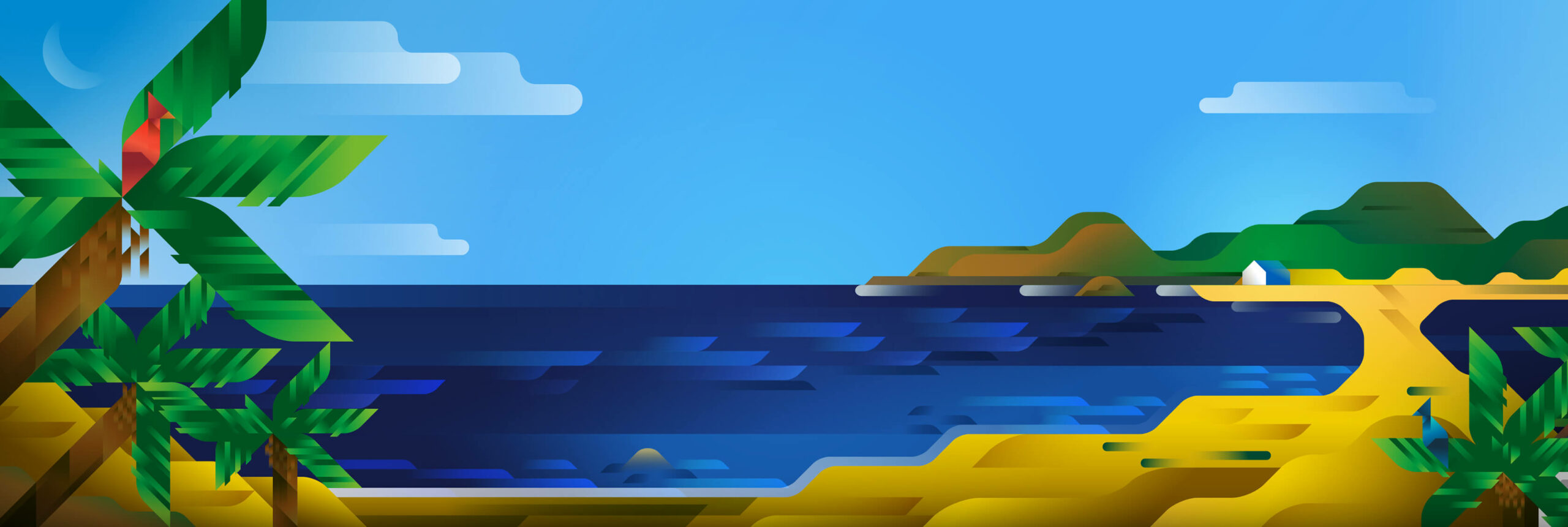
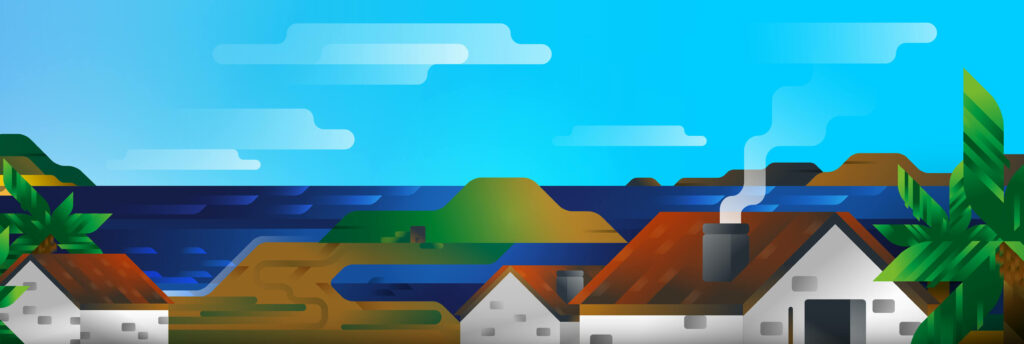
In our virtual tour we land in Gran Canaria on a morning of XIV century, in the triangle of sand where now stands the harbor district of Las Palmas and the beautiful paseo of Las Canteras. Through a small stripe of sand it is possible to reach a peninsula, that of La Isleta, so called probably because, in ancient times it was not connected to the main island through the sands of Las Canteras. So our story starts from here, from a slice of heaven between sand dunes and palm trees, which over the centuries has been shaped by man to become one of the most visited districts of Las Palmas, the site of one of the most beautiful European city beaches, Las Canteras indeed.
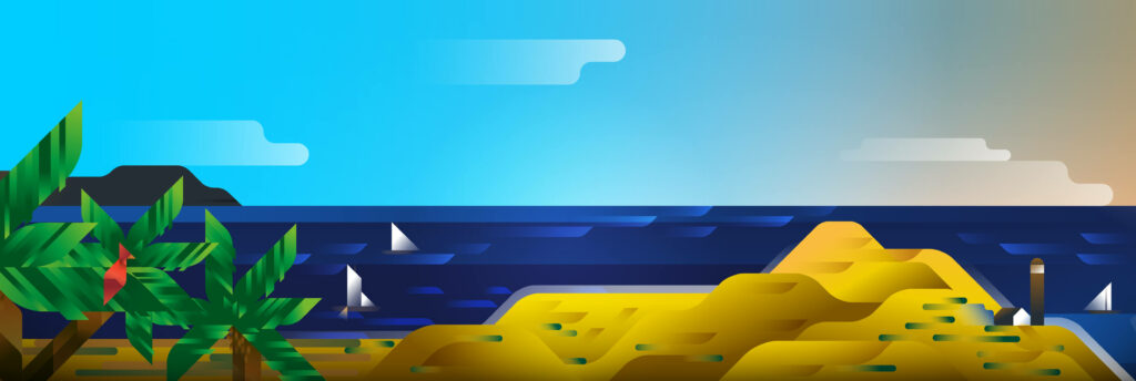
Leaving Las Palmas and following the coast towards the south, we reach another coastal landscape in a few kilometers, located on the east side of the island. What you can see in this second illustration is a typical Canarian landscape, a view of the Gando’s peninsula with the typical colonial houses of the municipality of Telde. This promontory, on the side of Gran Canaria, is important from the historical point of view as it represented the starting point for the conquest of the island by the Spanish Crown. The conquerors built the first vanguard tower, which soon became a shelter to face the indigenous peoples of the island and pirates. Today, facing this landscape, there is the only airport of Gran Canaria, better known as “Aeropuerto del Gando”; the peninsula was used for a period as a leper hospital and now it’s occupied by a military base, just next to the airport.
Continuing our journey to the south of the island, in the early afternoon we arrive at the famous dunes of Maspalomas, a small natural desert of 25 km2. It was impressive to discover such a natural and silent place, a place that in the past was even more wild, completely desert and very impervious, and now thanks to the rapid urban development of the 60’s has become a massive area for tourism, surrounded by an almost entirely artificial landscape. Despite of this, the dunes are considered a protected area, as they represent a unique habitat on the island, a place of migration for many species of birds, thanks to the small oasis that appear here and there in the dunes. It is incredible the healing power of the nature when it presents itself to our eyes as a stretch, whether it’s made of sand, water or grass.
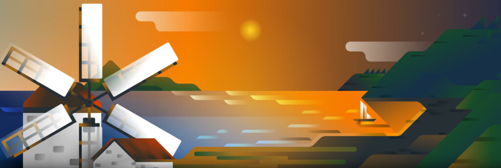
After reaching the southern half of the island with its dry and sunny shores, it’s time to go north along the west coast, characterized by deep and windy valleys that lead to the sea, passing through Mogán and its windmills up to the place where now there is the Aldea de San Nicolas. By now we have abandoned the sun of the early afternoon to enjoy the sunset seen by the western coast, an area of the island still completely wild and far from the center of the province. Thus, we find ourselves observing a coastal landscape different from the others: huge mountain ridges that lap the ocean waves showing small beaches of black sand and pebbles here and there. The west coast is totally different from the east, but offers sunsets impossible to appreciate elsewhere. It is often possible to observe the nearby coasts of Tenerife and recognize the top of Teide, the island’s volcano and highest peak of Spain.
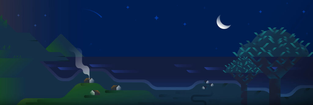
Finally, it’s night when we left Agaete and Galdar; back to the northern coast of the island in the moonlight, along green promontories of banana trees, sugar canes, palm trees and “dragon trees”. From this point of view it’s possible to admire small groups of isolated houses, the same that constituted the typical pueblos of the northern coast, such as Moya, Firgas, Arucas and Galdar, the latter well recognizable by the almost conical shape of the mountain that protrudes on the ocean. The pueblos sleep on a placid night of this eternal spring, with the stars of the sky observing this slice of heaven…